|
Tasmanian Class 1 Load Carrying Network Map Help
|
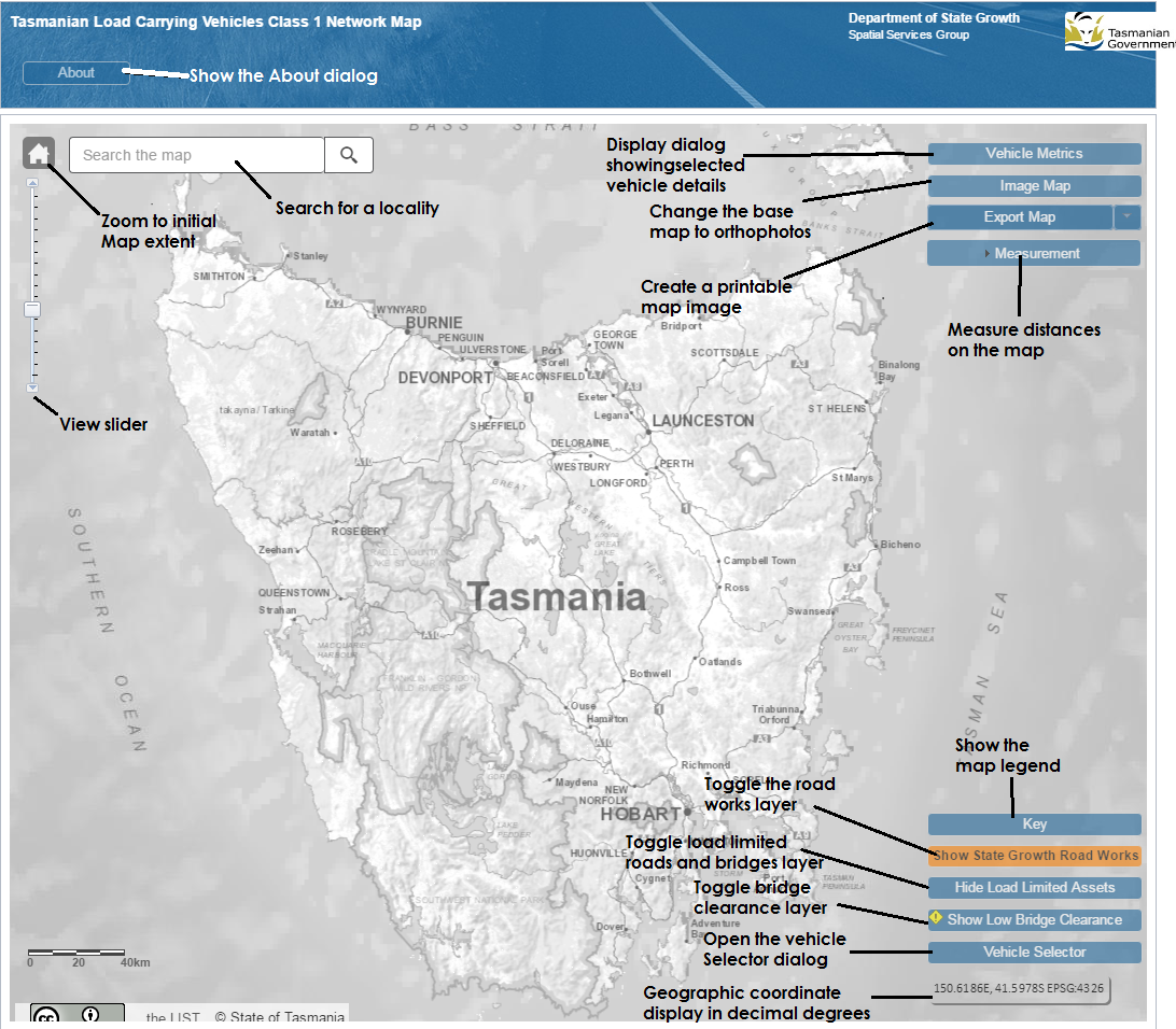
Map components

Vehicle Selector

When the Vehicle Selector displays for the first time there will be three buttons visible. Click the button that is appropriate for our vehicle. Choose the correct options. When you have made a valid choice details about your selection will be displayed as well as Terms and Conditions. Read these and click Agree and Update Map to proceed. The map will update showing the road network for the entered vehicle.
Vehicle Metrics

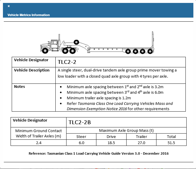
Clicking the Vehicle Metrics button will display a dialog that contains information relating to the selected vehicle. Oversize and Overmass vehicles will contain an image showing the vehicle configuration.
Map Legend
To see what information and layers is available on the map click the Key button. The following dialog is displayed

The Legend contains a number of links which can be clicked to gain more information.
Clicking on the word Notice will open a page with the legislated notice conditions.
Clicking on See diagram brings up the Pilot and Escort matrix for that type of road (Green, Orange, or Blue)
Clicking on More details on Roador Bridge subject to load limit displays a dialog with information
about Load Limited roads and bridges.
In the section titled No Access Under Notice shows which roads cannot be traversed without obtaining a further permit from NHVR the Contact NHVR link goes to a page on the NHVR web site to start this process.
Roadworks
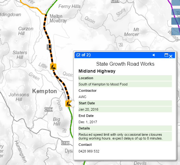
Clicking the Show State Growth Road Works button will turn on the layer containing the currently active roadworks. Clicking the mouse on one of the roadworks will bring up an info box with data about the roadworks. This box includes a Site contractor and a cantact phone number.

Bridge Clearances
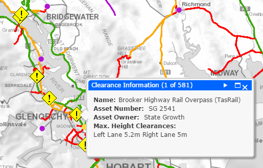
Turning on the bridge clearance layer, by clicking on the Show Low Bridge Clearance button, shows the location of bridges with a height clearance less than or equal to 5.0m. Clicking on the Clearance icon will display information about the clearances for each lane.
